Art
Advertising
- Advertising
- Tin (Cassiterite) Distribution: Mediterranean Bronze Age
- Archaeological Sites of the Aegean Minoans
- Extent of Santorini Eruption's Tsunami Inundation of Minoan Crete
- End of Minoan Linear A Writing and LM IB Fire Destruction of Crete
-
Nature Geoscience Journal and
Late Minoan IB Destruction Event -
The Cause of the End of the Bronze Age
with the Scientific Method - Prehistoric Star Navigation, Eastern Mediterranean Ethnocentric Bias, and the "Cabal of Certainty"
- Theoretical Bronze Age Minoan Heliographic Aegean Network Validated by 92.15 Mile (148.3 Km) Mirror Sunlight Flashes
- The Validation of a Bronze Age Minoan Heliographic Aegean Network in Southern California
- Tsunami Generation from the Titanic Bronze Age Minoan Eruption of the Santorini Marine Volcano
- The Cento Camerelle Mines of Tuscany: A Major Bronze Age Source of Tin
- No Men or Sails Required: Successful Prehistoric Sea Travel
- Minoan Downfall and Volcanology's Black Hole of Unknowns
- Homer and Navigating by the Stars in Prehistory
- Primacy of Human Powered Rowing in Copper Age and Minoan Shipping
- Minoan Invention of the True Dome and Arch Prehistoric Mediterranean Catenary Architecture
- "Sinking Atlantis" Tsunami Myth Debunked
- Minoan Tholos Structural Mechanics and the Garlo Well Temple
- Minoan Web of Mirrors and Scripts
- Santorini Eruption and LM IB Destruction
- Minoan Catastrophe: Pyroclastic Surge Theory
- Early Minoan Colonization of Spain
- Origin of the Sea Peoples
- Minoan Ship Construction
- Minoan Maritime Navigation
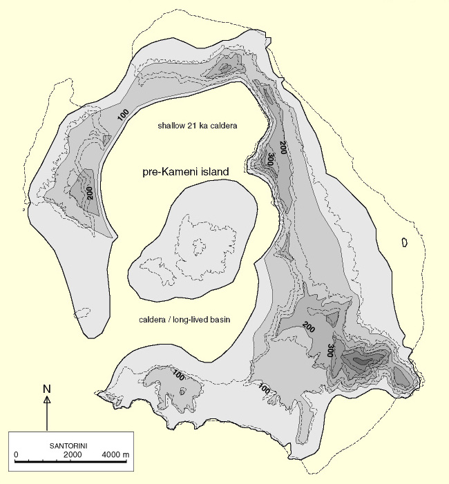
- Ringed Islands of Thera, Santorini, Greece
- Minoan Scientific Tradition
GIS Google Earth
Publications
Publications
Official Art Gallery
A Collection of 20 Paintings each with over 70 Art Products
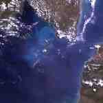
In the summer of 2011 I watched the German documentary 'Expedition nach Atlantis' which implied a huge tsunami wavefront from the great Santorini eruption was responsible for a major destruction of Minoan Crete and decided some mythbusting was very much in order. The vast majority of tsunami destruction occurs during it's run-up and inundation on land. If you want to see if it's possible for a wavefront that's 20 to 30 meters (66 to 98 feet) high (max.) to cause the downfall of Minoan civilization then you need to reasonably accurately determine the land area on Crete inundated. The excellent new publication 'Modelling of tsunami generated by the giant Late Bronze Age eruption of Thera, South Aegean Sea, Greece', T. Novikova, G. A. Papadopoulos and F. W. McCoy specifies a variable tsunami wavefront that is up to 28 meters (92 feet) high (max.) and includes a low resolution 450 meter (492 yards) maximum inland inundation limit.
I've known it was impossible for any volcanic tsunami in the Aegean to destroy anything more than the very limited low elevation coastal zones on Crete for some years now because of my work on 'The Archaeological Sites of the Aegean Minoans' GIS mapping project. This free geographical tool has aided the work of many hundreds of scholars over the last few years. While this would have been a terrible tragedy for those in the inundated coastal areas the simple truth is that Crete is mountainous with rising elevations that would quickly dwarf and reflect any tsunami wavefront back into the sea.
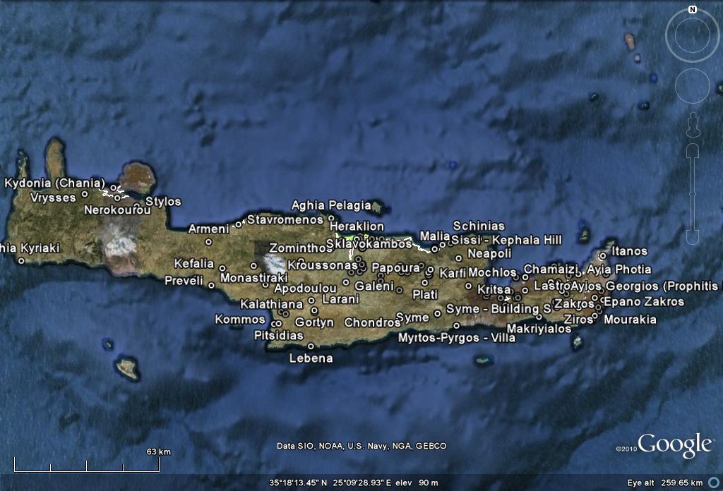
I've provided links to a slide show of seven map images derived from Google Earth to conclusively demonstrate this. These maps include most of the 'non-sensitive' Minoan archaeological sites on Crete, the 450 meter maximum inland inundation limit described in Novikova's paper, the 12 meter (39 feet) USGS ITST measured maximum run-up elevation from the 2004 tsunami in Sri Lanka, and the topographical elevation contours of 28 and 40 meters (92 and 131 feet) for a section of the coast north of Knossos.
I've known it was impossible for any volcanic tsunami in the Aegean to destroy anything more than the very limited low elevation coastal zones on Crete for some years now because of my work on 'The Archaeological Sites of the Aegean Minoans' GIS mapping project. This free geographical tool has aided the work of many hundreds of scholars over the last few years. While this would have been a terrible tragedy for those in the inundated coastal areas the simple truth is that Crete is mountainous with rising elevations that would quickly dwarf and reflect any tsunami wavefront back into the sea.
I've provided links to a slide show of seven map images derived from Google Earth to conclusively demonstrate this. These maps include most of the 'non-sensitive' Minoan archaeological sites on Crete, the 450 meter maximum inland inundation limit described in Novikova's paper, the 12 meter (39 feet) USGS ITST measured maximum run-up elevation from the 2004 tsunami in Sri Lanka, and the topographical elevation contours of 28 and 40 meters (92 and 131 feet) for a section of the coast north of Knossos.
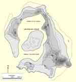
Google Earth Slideshow

Minoan Crete Tsunami Inundation Map 1

Crete Tsunami Inundation Map 2

Crete Tsunami Inundation Map 3

Crete Tsunami Inundation Map 4
Crete Tsunami Inundation Map 5

Crete Tsunami Inundation Map 6

Crete Tsunami Inundation Map 7
The tsunami expert Costas Synolakis who appeared in the documentary "Secrets of the Dead: Sinking Atlantis" broadcast in May 2008 claims to have a higher resolution inundation map of Crete that is accurate to within 50 meters. But, to the best of my knowledge, it remains unpublished and unavailable. Clues to the character of this map can be found in the documentary "Atlantis: The Evidence" broadcast in June 2010. While no inundation map is ever shown, it states - "It's been estimated that the Theran tsunami rose at least 65 feet [19.8 meters] above sea level in places and traveled up to five miles [8 kilometers] inland." This maximum wave height is significantly less than that of the Novikova paper. Also, you can see exactly where this 5 mile penetration must have occurred in my map - the deep river valley west of Knossos.
Late in the show Bettany Hughes queries Costas Synolakis and the archaeologist Alexander "Sandy" MacGillivray on their vision of the tsunami destruction of Minoan Crete. Costas states, "In our view the impact of the Minoan tsunami in Crete was very similar to the impact of the Boxing Day tsunami, the 2004 tsunami in Sri Lanka." "We think that the size of the wave off Amnisos here was very similar to the size of the wave off Sri Lanka. So this is a very good sort of analogy to try to visualize what it must have looked like to the Minoans, the wave coming in."
While the incoming wavefront probably appeared similar, he fails to mention Sri Lanka's coastlines are replete with large very low elevation flood plains that are highly susceptible to tsunami damage. This comparison to the mountainous coastlines of Crete is ludicrous and utterly invalid. With Costas' inundation map unavailable, we've added the Sri Lanka International Tsunami Survey Team's (ITST, 2005) measured maximum run-up elevation of 12 meters to our map. Their exact statement is that run-up "varied from less than 3 meters to more than 12 meters."
The heights of the incoming tsunami waves from the great eruption seen along the coastlines of Minoan Crete would have been quite variable as determined by, among other factors, the focusing and defocusing effects of the off/nearshore underwater terrain (bathymetry). Once onshore it's path of destruction would be influenced by anything in front of it but especially by the land's topography. Only in places where the overall focusing of the wave was greatest would the tsunami have any hope of topping the 40 meter elevation contour while in other places it would have been well within the 12 meter Sri Lanka ITST maximum elevation limit or Novikova's 450 meter inland inundation limit.
After Costas states, "30,000 people died in Sri Lanka in only a few minutes." Bettany asks, "So if you've got 70% of the population dying, what do you think, Sandy, that says about what happened to Crete because most people live along the coast, don't they?" Sandy responds, "I think so, there's the city Knossos which is inland but otherwise it's very much open coastline, unprotected harbors and so the death toll would have been staggering, phenomenal." To the best of my knowledge, MacGillivray has never presented any evidence in support of this statement of personal belief. This must be because there simply is none. He completely ignores the rich and growing Minoan archaeological record on Crete as our maps amply show. This is a very sad chapter in what is otherwise a very informative, excellent documentary.
I hope this helps to finally put to an end the utterly unfounded myth of a wide spread destruction of mountainous Crete by tsunami and the absurdity that most of the Minoans lived on the coast within the inundation zones which comprise less than 1% of the land area of Crete. With the demise of this myth there is now only one well established volcanic phenomenon actually capable of reaching out and causing a significant destruction of the Minoans left standing with its validity intact - pyroclastic surge.
This is more precisely described as a titanic explosive venting of a roughly consolidated pool of about 3 or more cubic kilometers of seawater swallowed by the magma and held for long enough to be heated to something near to it's ambient temperature of about 1,100°C (2,012°F). Because of the water to steam volume expansion of about 1,600 times this translates into 4,800 or more cubic kilometers of super-heated dry steam supersonically ejected with jaw-dropping force onto the surface of the Aegean. This is the same volume expansion that drives most of the world's power plants.
Perhaps there was no Santorini based destruction of ancient Crete but while building this case I came to re-examine the evidence for the effects of a high temperature steam pulse on Crete that I originally researched about two or three years ago. The more I look at it the more perfectly the so-called Late Minoan IB destruction event (horizon) describes the expected effects from a steam pulse. Most papers that take a serious look at this period have a primary association with a wide spread fire destruction of central and eastern Crete. Besides the "disappearance" of Linear A writing which was well distributed throughout this area at the time of the eruption perhaps the strongest evidence is from the archaeomagnetics which seems to indicate a uniform very high temperature heating on Crete. Particles of magnetite contained in mud bricks were thermally demagnetized at above their Curie temperature of about 600°C (1,112°F) and were then permanently realigned to the earth's prevailing magnetic field on cooling.
W. S. Downey, D. H. Tarling. "Archaeomagnetic Results from Late Minoan Destruction Levels on Crete and the 'Minoan' Tephra on Thera". "Thera and the Aegean World III". Volume Three: "Chronology", Proceedings of the Third International Congress, Santorini, Greece, pp. 146 - 159, 3-9 September 1989.
The following article has always intrigued me because I've long thought that if ever a definitive link between the eruption and Crete's fire destruction was found it would be through detailed soil analysis. I wonder if some of the information in this article can be connected to a supersonic steam pulse as opposed to conventional ash fall.
G. Cadogan, R. K. Harrison. "Evidence of Tephra in Soil Samples From Pyrgos, Crete". C. Doumas (Ed)., "Thera and the Aegean World I". London, pp. 235 - 255, 1978.
If this is true, snapping the Late Minoan IB destruction event into chronological alignment with the great eruption will have profound and wide ranging implications. Many now comfortable assumptions will have to be seriously questioned and discarded. But much more importantly I hope the potential hazards of some of the world's active volcanoes are re-assessed to appropriately include the incredibly dangerous risk of blasts of super-heated steam.
Here's a time-lapse YouTube video of the interior of a high-intensity forest fire (with temperatures) that shows just how terrible of a destruction this would have been.
Click on Image to Play Video
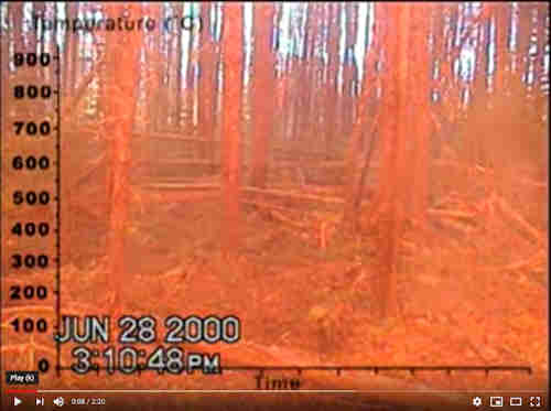
High-Intensity Forest Fire Video (2:20)
Bibliography:
T. Novikova, G. A. Papadopoulos, F. W. McCoy. "Modelling of tsunami generated by the giant Late Bronze Age eruption of Thera, South Aegean Sea, Greece", Geophysical Journal International, Volume 186, Issue 2, pages 665 - 680, August 2011.
W. S. Baird. "The Bronze Age Eruption of Santorini and Late Minoan IB Destruction Event", 2009.
W. S. Baird. "The Extent of the Santorini Eruption's Tsunami Inundation of Minoan Crete", GIS Mapping, 2008.
W. S. Baird. "The Minoan Catastrophe: The Theran Pyroclastic Surge Theory", 2007.
W. S. Downey, D. H. Tarling. "Archaeomagnetic Results from Late Minoan Destruction Levels on Crete and the 'Minoan' Tephra on Thera". "Thera and the Aegean World III". Volume Three: "Chronology", Proceedings of the Third International Congress, Santorini, Greece, pp. 146 - 159, 3-9 September 1989.
G. Cadogan, R. K. Harrison. "Evidence of Tephra in Soil Samples From Pyrgos, Crete". C. Doumas (Ed)., "Thera and the Aegean World I". London, pp. 235 - 255, 1978.
October 26, 2011
W. Sheppard Baird
Copyright © 2007, 2024 W. Sheppard Baird
All Rights Reserved
All Rights Reserved
-

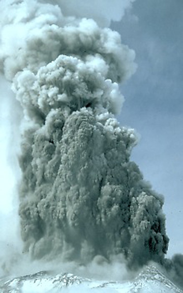
Mt. Pinatubo Eruption
Luzon, Phillipines
1991
-
Volcanic Phreatic Eruption
-

Spring Fresco West Wall
Swallows Scene
Akrotiri, Santorini (Thera), Greece
-
Volcanic Pyroclastic Surge
Montserat, Caribbean
1996
-
Krakatau
Sunda Strait, Indonesia
-
Pre-Eruption Minoan Thera
Santorini, Greece
-
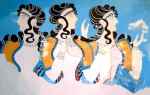
Minoan Ladies in Blue Fresco
Knossos, Crete, Greece
-
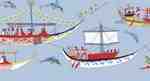
Minoan Miniature Frieze
Admirals Flotilla Fresco
Shipping Scene Restoration
West House, Room 5, South Wall
Akrotiri, Santorini (Thera), Greece
-

Mt. Pinatubo Eruption
Luzon, Phillipines
1991
-
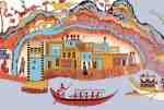
Minoan Miniature Frieze
Admirals Flotilla Fresco
Thera Restoration Scene
West House, Room 5, South Wall
Akrotiri, Santorini (Thera), Greece
-
Minoan Dolphins Restoration Fresco
Knossos, Crete, Greece
-

Minoan Sea Daffodils Lilies Restoration Fresco
Akrotiri, Santorini (Thera), Greece
-
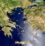
Aegean Sea
-

Anak Krakatau
Sunda Strait, Indonesia
-

Minoan Antelope Restoration Fresco
Akrotiri, Santorini (Thera), Greece
-

Anak Krakatau
Sunda Strait, Indonesia
-
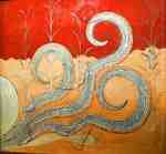
Minoan Octopus Fresco
Knossos, Crete, Greece
-
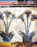
Minoan Sea Daffodils Lilies Fresco
Akrotiri, Santorini (Thera), Greece
-

Minoan Bull Leaping Toreador Fresco
Knossos, Crete, Greece
-

Minoan Antelope Fresco
Akrotiri, Santorini (Thera), Greece
-
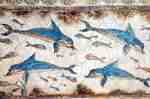
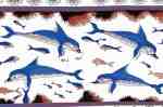
Minoan Dolphins Fresco
Knossos, Crete, Greece
-

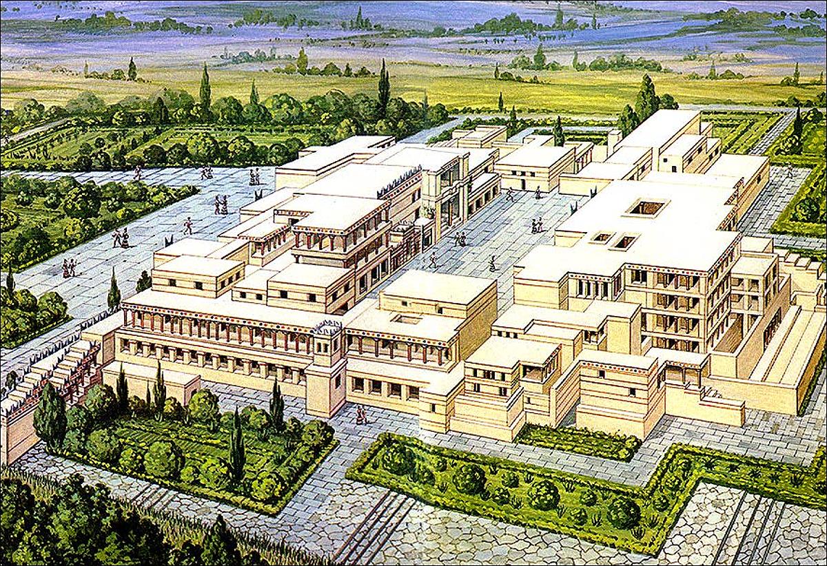
Knossos Reconstruction
Crete, Greece
-
Knossos Reconstruction
Crete, Greece
-

Thera
Santorini, Greece
-
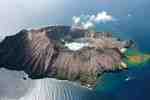
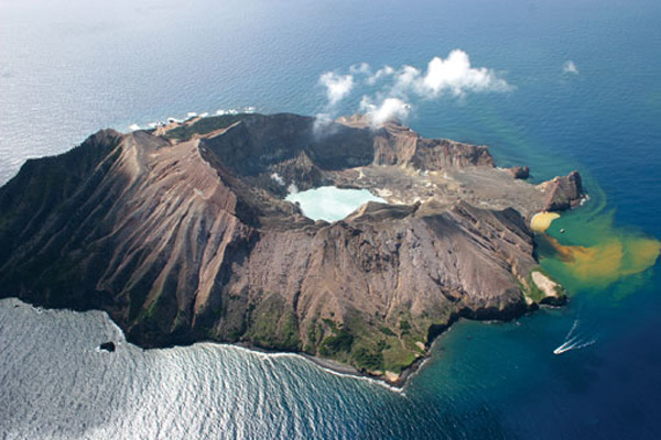
White Island Marine Volcano
New Zealand